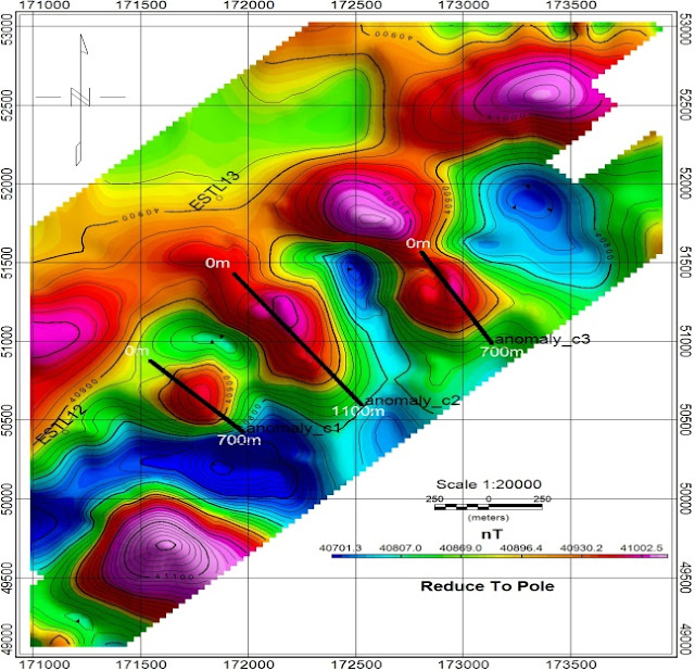
Ground magnetic surveys are a valuable tool in mineral exploration, offering cost-effective and non-invasive means of mapping subsurface geology and identifying potential mineral deposits. When integrated with geological and other geophysical data, magnetic surveys enhance exploration targeting and aid in decision-making processes, ultimately contributing to the discovery and development of mineral resources.
Magnetic anomalies may arise from various sources, including
geological structures, mineral deposits, and anthropogenic features. This
surveys enable the mapping of subsurface structures such as faults, folds, and
geological contacts, which are crucial indicators of potential mineralization.
Many mineral deposits, including iron ore, base metals, and
certain precious metals, exhibit magnetic properties. The following image is showing
the iron ore magnetic anomalies from South Kalimantan.
Prospect zone divide onto three area prospects of north
block, central block and south block are based on indicated high value of
susceptibilities with red to purple color index on the Reduce to Pole (
We are intensively using Geotron Model G5 Proton Memory
Magnetometer for magnetic data acquisition from several survey area.


